J R Associates

J R Associates

Geophysical Surveys for Geologists


Providing a variety of geophysical investigative methods for over 30 years.


Geophysical Surveys

Geophysical surveys are used when information on what is below ground is needed. Geophysics has many uses such as looking at the depth and extent of landfills, determining the depth and strength of bedrock, looking for old buried infrastructure, finding buried stream channels and faults, imaging landslides, measuring shear wave velocities and shear strength, and monitoring ground vibrations during construction.


  • Seismic Refraction
    The main use for seismic refraction is determining the depth to bedrock and rock rippability for grading projects. It is also used for finding groundwater depth and locating fault offsets.
  • MASW Shear Wave Surveys
    Multichannel Analysis of Surface Waves (MASW) is a method for determining shear wave velocities and geologic structures. We use it for Vs30 shear strength studies, general geology profiling, and to locate faults.
  • Magnetic Investigations
    Magnetic investigations are our main tool for finding buried objects such as old fuel tanks, old foundations, and old trash pits that can hinder construction at redevelopment sites.

  • Ground Penetrating Radar
    Ground penetrating radar (GPR) provides images of near-surface buried objects. In sandy and coarse grained soils it can image buried pipes, fuel tanks, and detect voids beneath pavement. It also maps rebar in concrete walls and pads.
  • Resistivity Profiling
    Resistivity maps changes in soil and rock types with depth. It distinguishes conductive materials like clays and trash, from nonconductive materials like sandy soils and bedrock. It maps permeable zones for groundwater and environmental studies and maps landfill depths.
  • Vibration Monitoring
    Vibration monitoring confirms that ground vibrations during pile driving or vibratory compaction are at safe levels and not damaging to nearby buildings. Vibration levels are permanently recorded to address possible complaints.

Recent Surveys

Below are four examples of recent geophysical investigations

Salton Sea

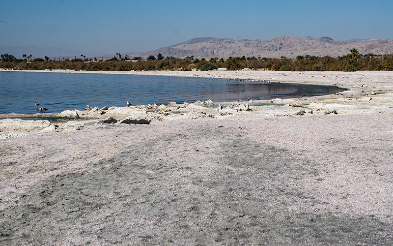
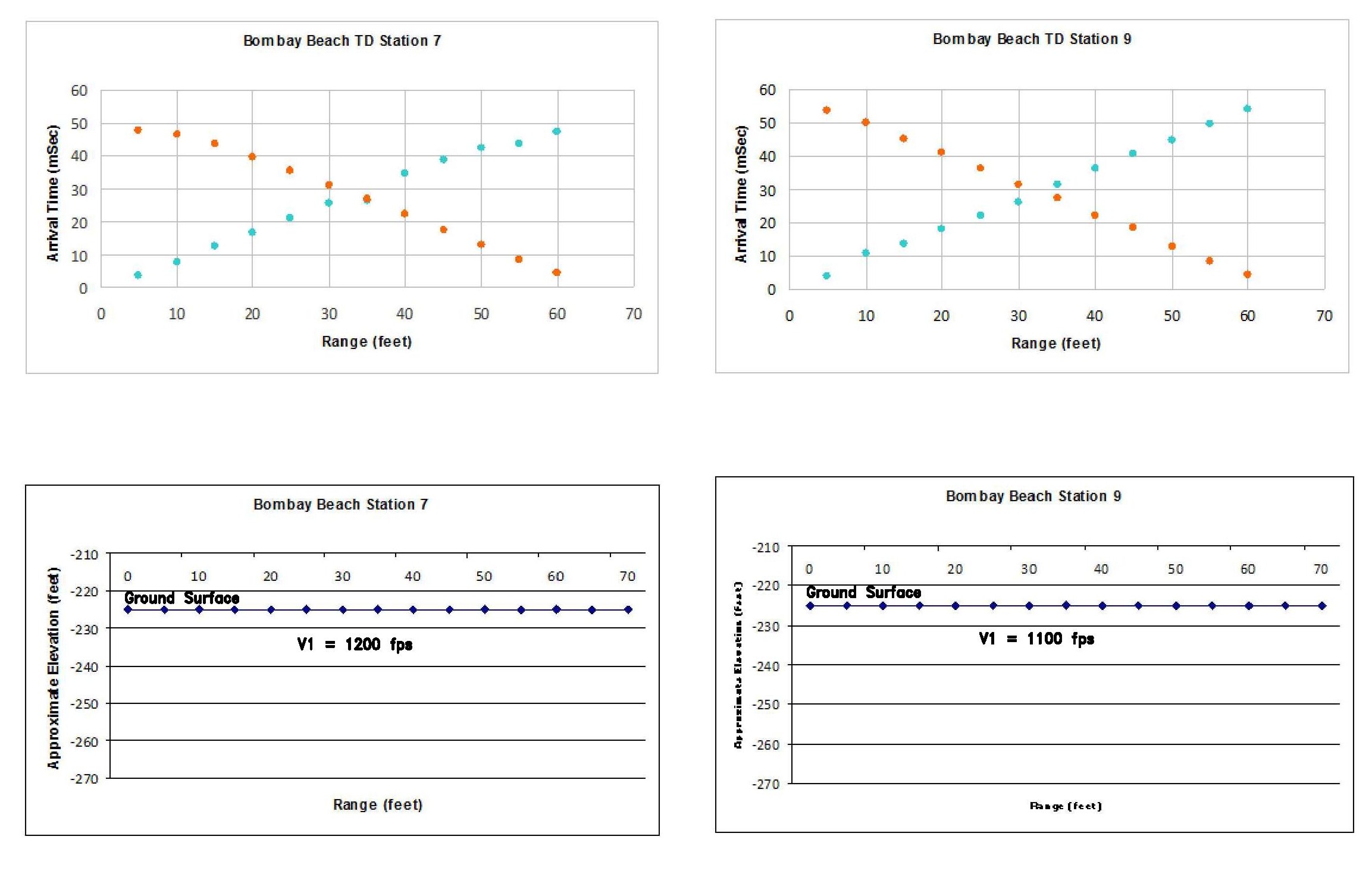
Salton Sea Geophysical Study

We performed seismic refraction surveys to determine groundwater depth and performed dipole resistivity surveys to determine near surface soil types in four regions around the Salton Sea. The geophysics supported a dust storm mitigation study.
Fort Funston Outfall

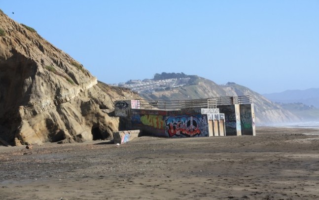
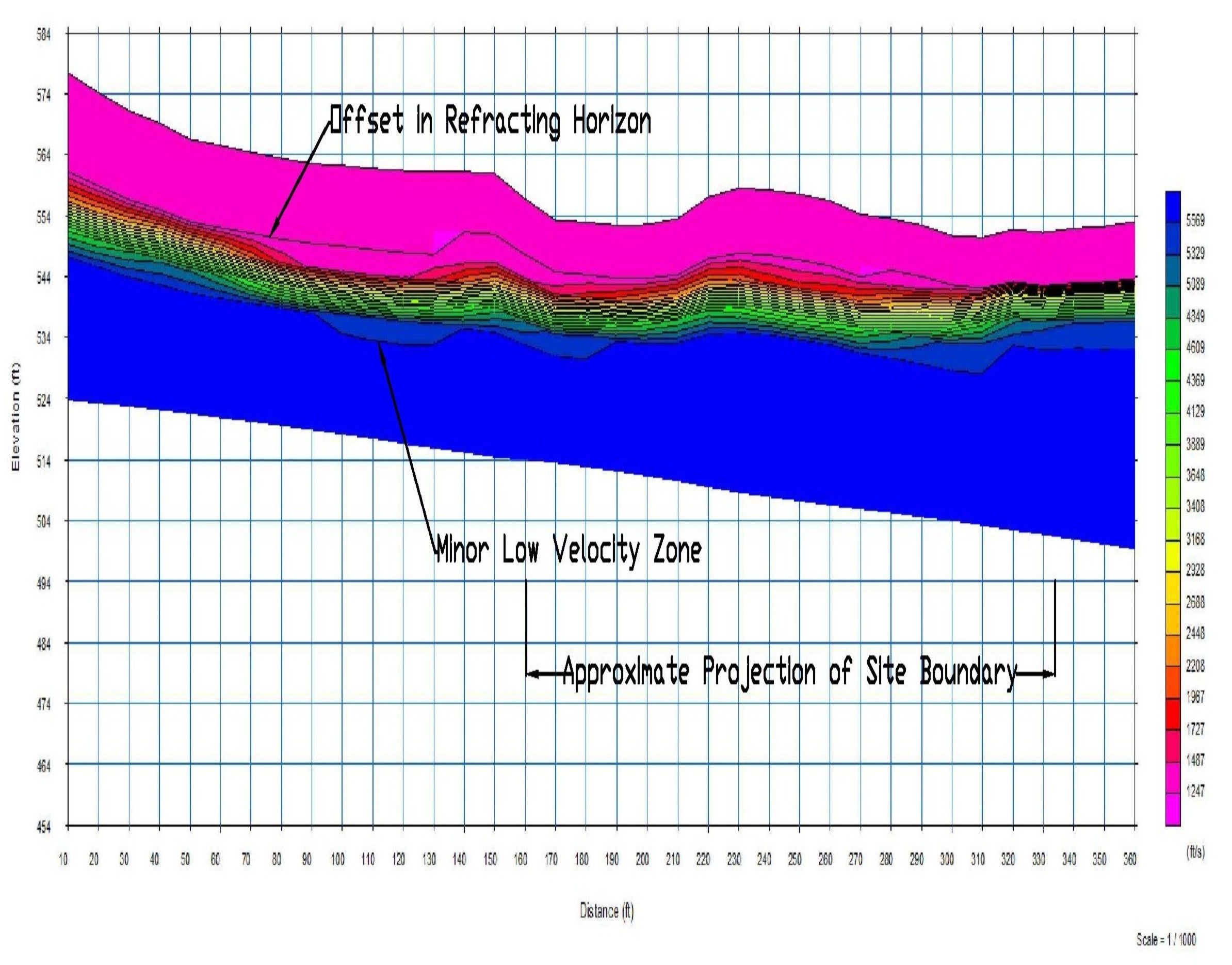
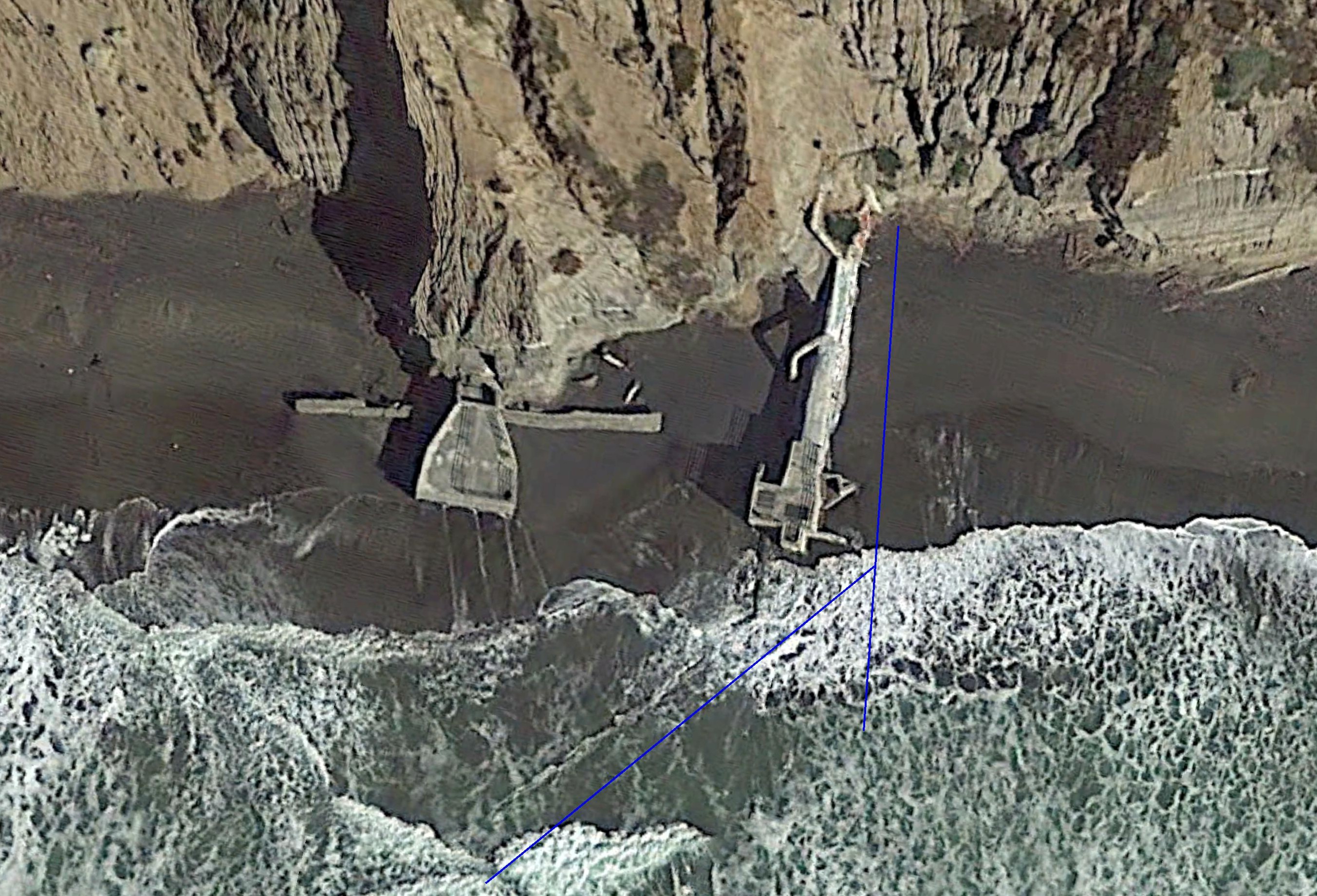
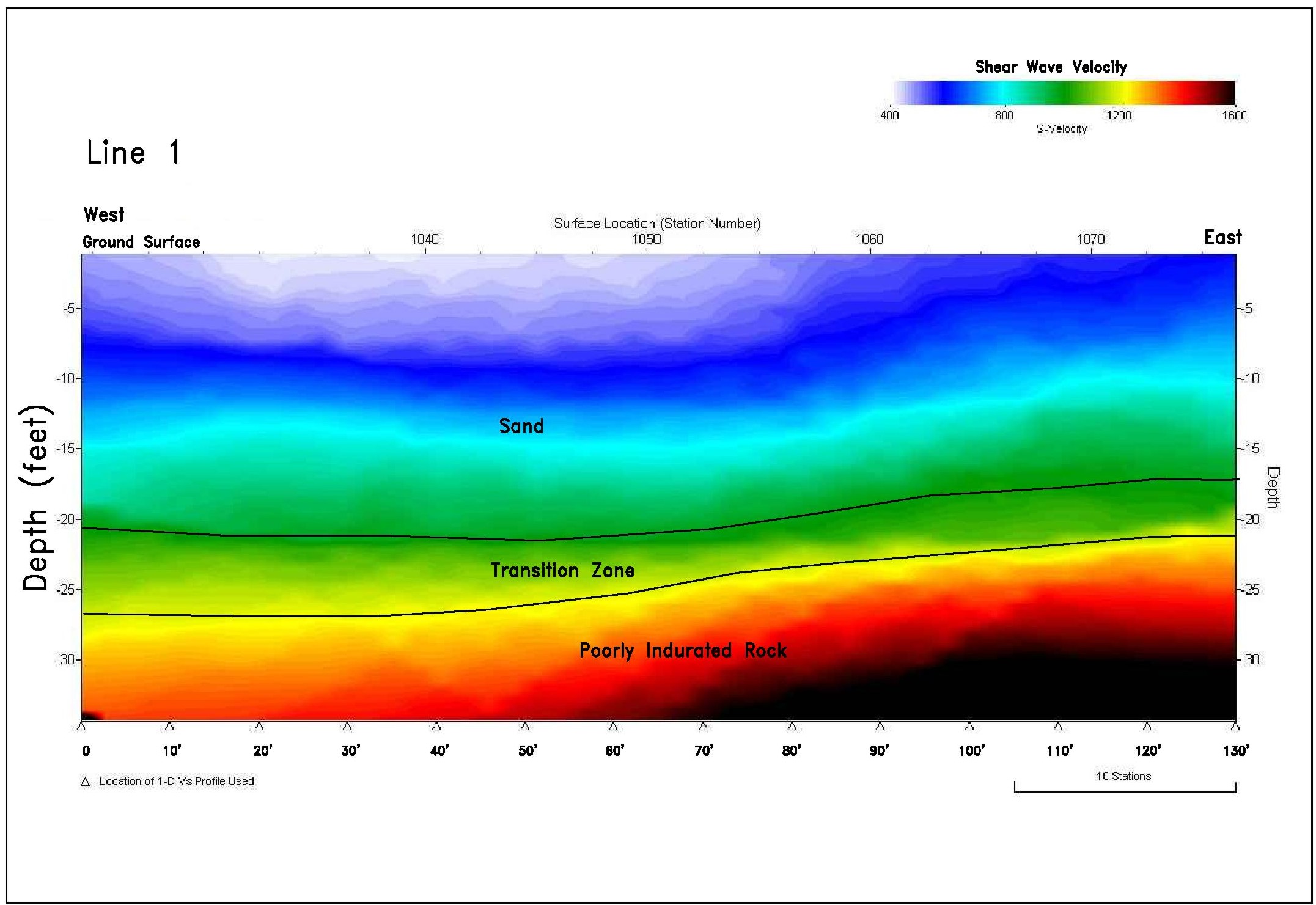
Fort Funston Bedrock Mapping

Multichannel Analysis of Surface Waves (MASW) was used to determine the depth to bedrock for a proposed sewer outfall at Fort Funston.
Salton Sea Refraction Profiles
Refraction Profiles
salton Sea Resistivity Profiles
Resistivity Profiles
Florin Road
MASW Line Locations
CAD Drawing
Shear Wave Profile


Land Fill

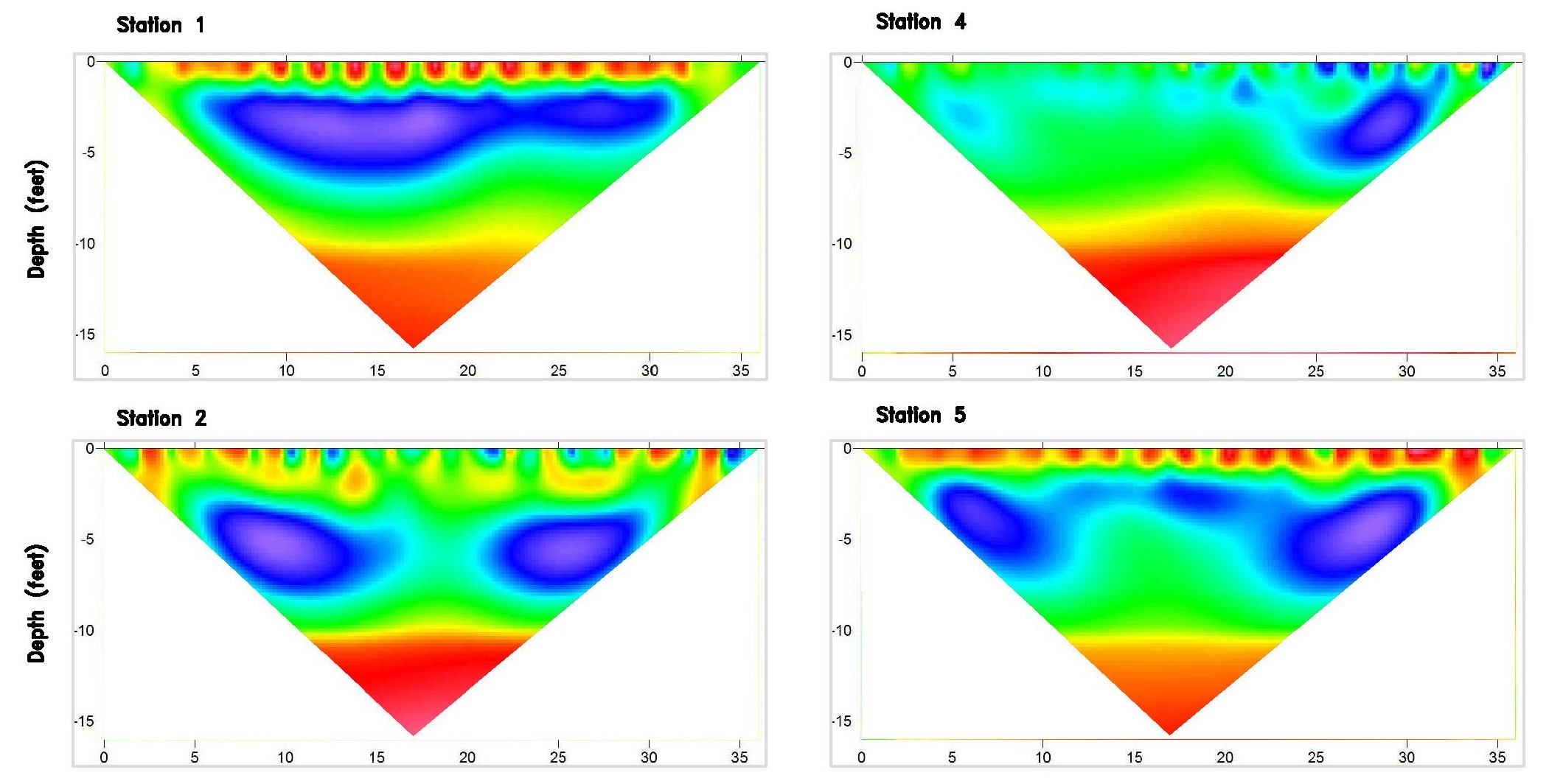
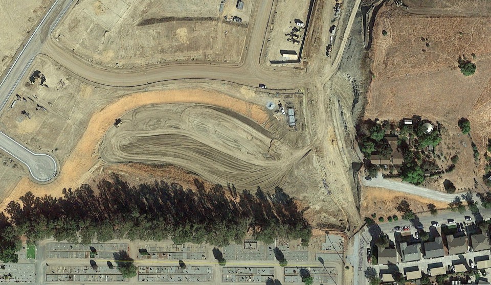
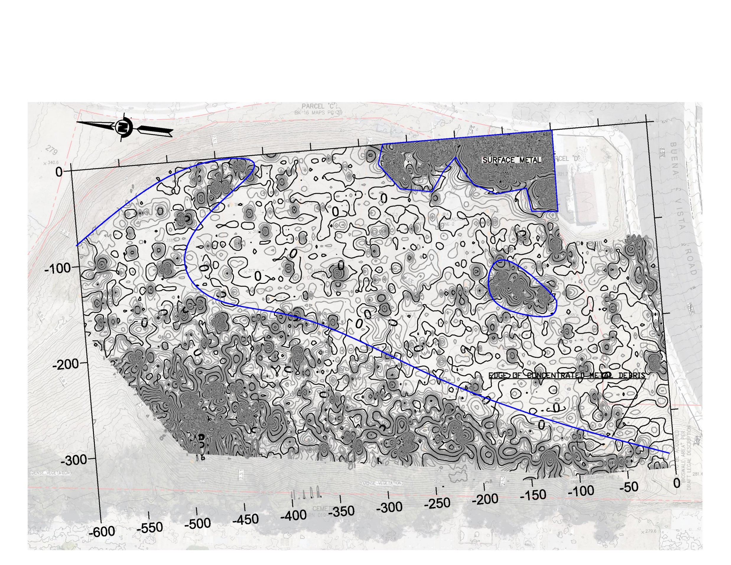
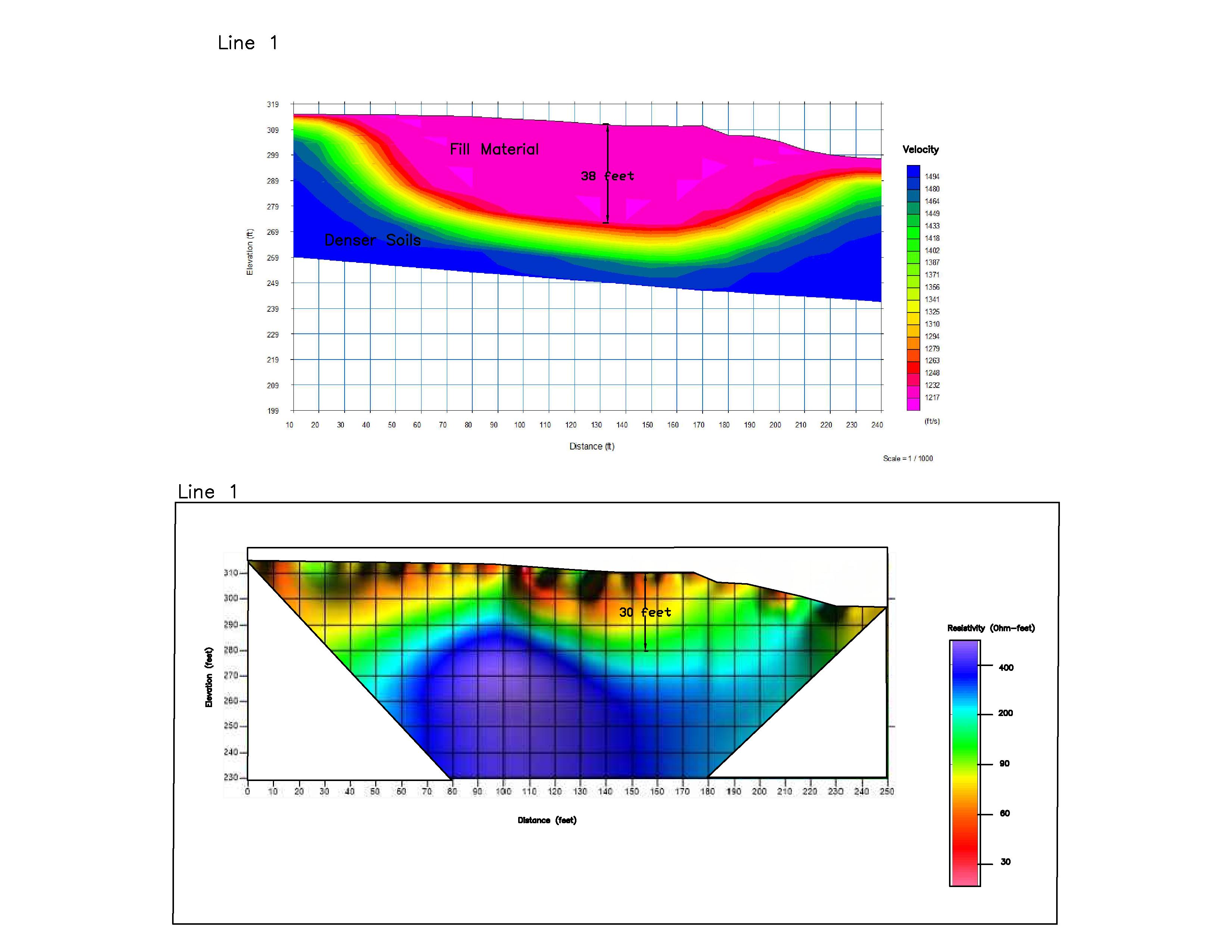
Landfill Investigation

To characterize an old landfill, a combination of magnetics, resistivity, and seismic refraction was used. Magnetics defined the fill's lateral boundaries. Seismic refraction and resistivity found the fill's depth.
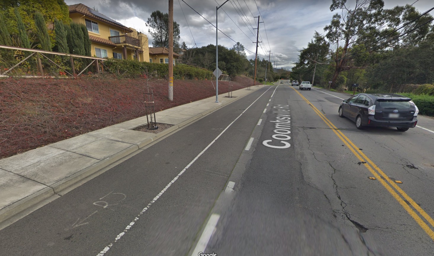
Powell Street

Rippability Study

We performed a seismic refraction survey to determine rock rippability for a new sewer line along a road in Napa.
Magnetic Map
Magnetic Map Showing Fill Boundaries
Geophysical Profiles
Refraction and Resistivity Profiles
Portable Seismic Equipment
Refraction Profile
Refraction Profile

J R Associates Civil and Environmental Geophysics

Morgan Hill · California · 408-293-7390

jra@greatgeophysics.com