J R Associates

J R Associates

Aerial Mapping, Visualizing Buried Utilities


Providing air photos using cutting edge technology


Photomosiacs

J R Associates applies the latest UAV and mapping technology to provide accurate air photos that turn utility field markings into compelling visual documents. In as little as 30 minutes our UAV can cover several miles of proposed pipeline or acres of land and provide an accurate up to date geo.tif air photos of utility markings within a day. At an altitude of 200 feet or less the UAV provides much greater detail than air photos obtainable on the internet.


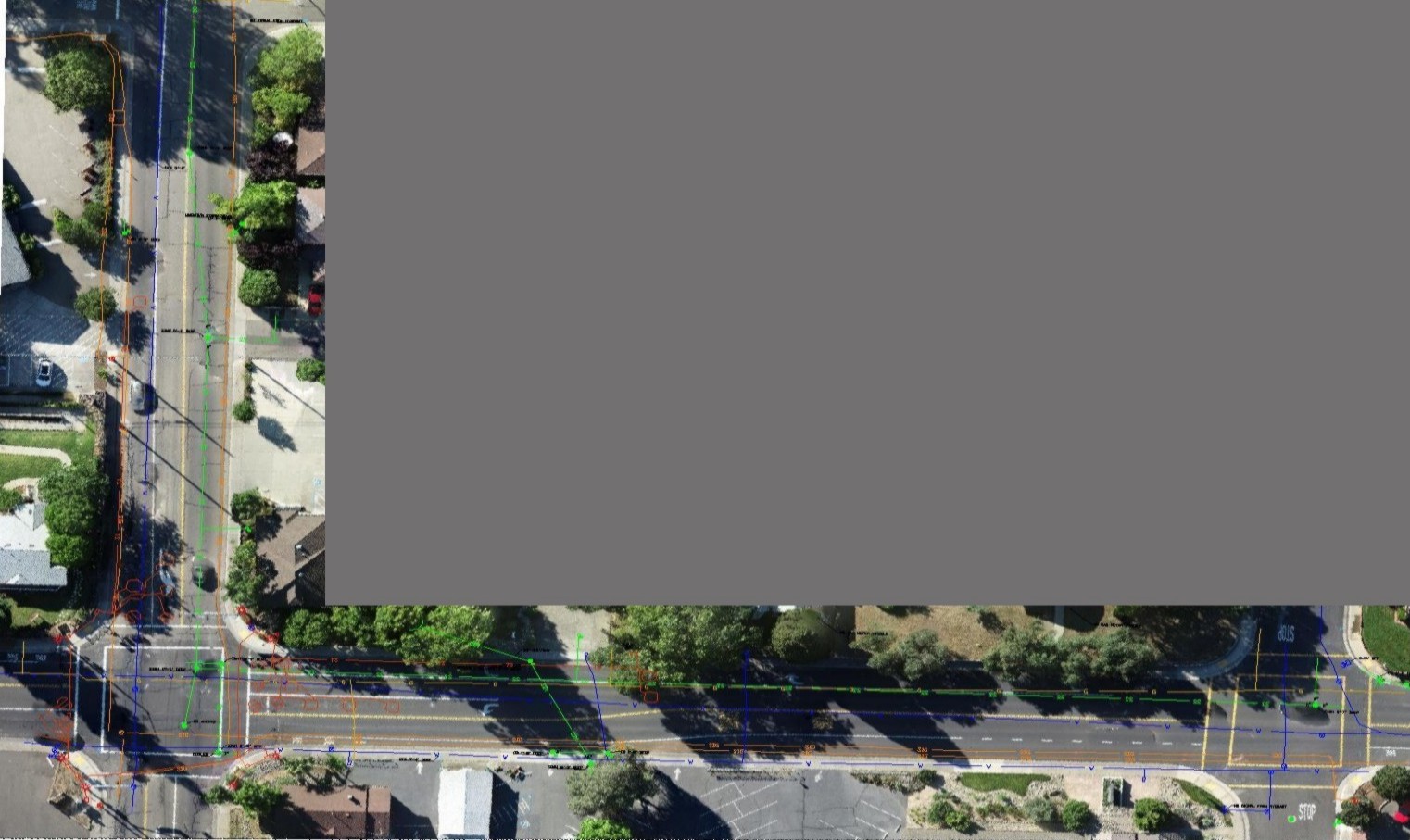
  • Utility Infrastructure Projects
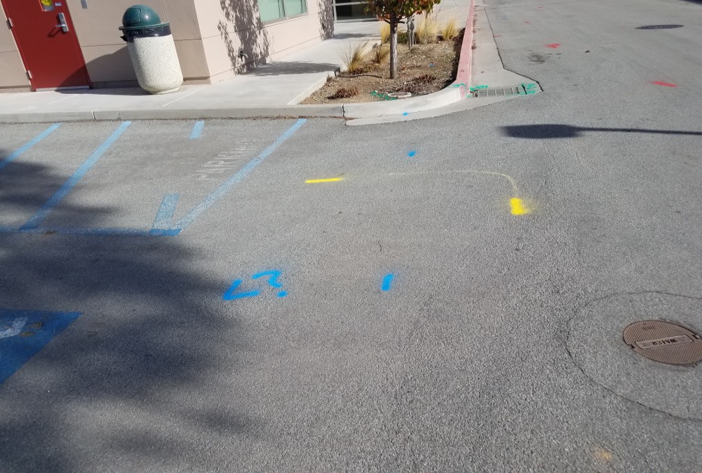
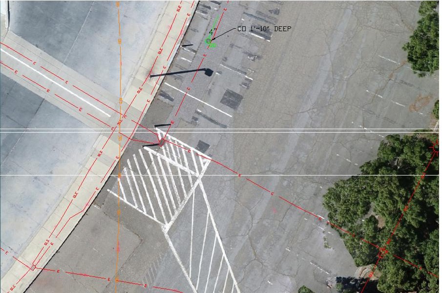
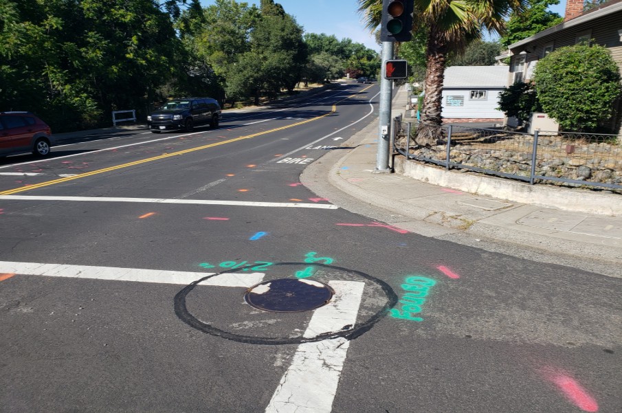
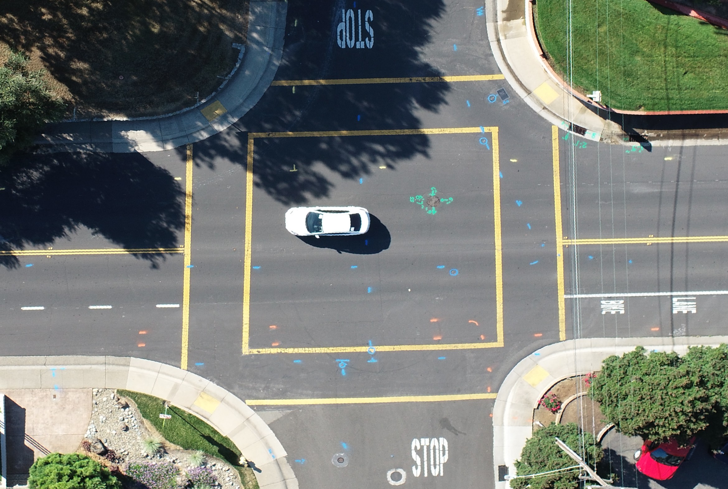
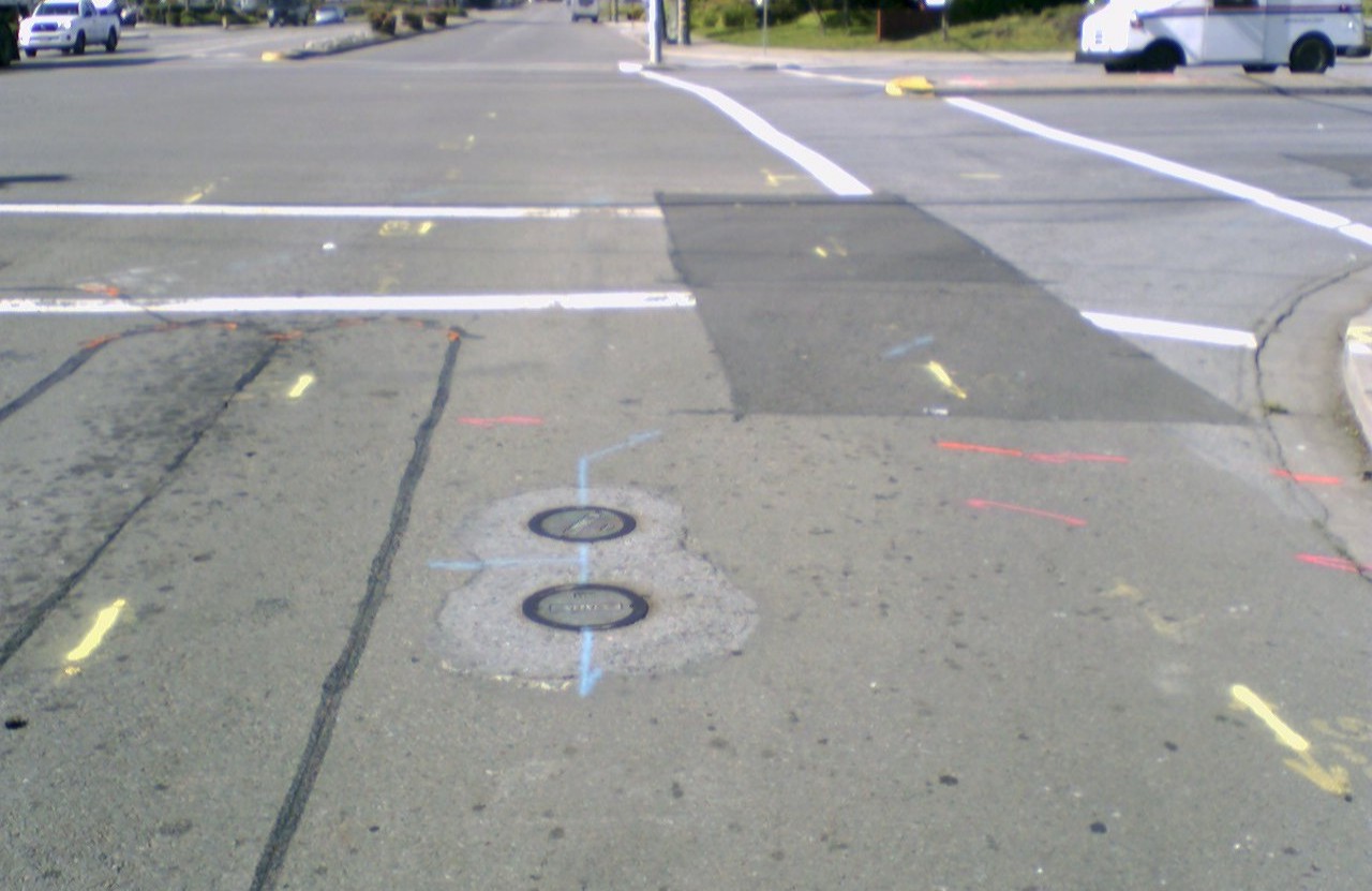
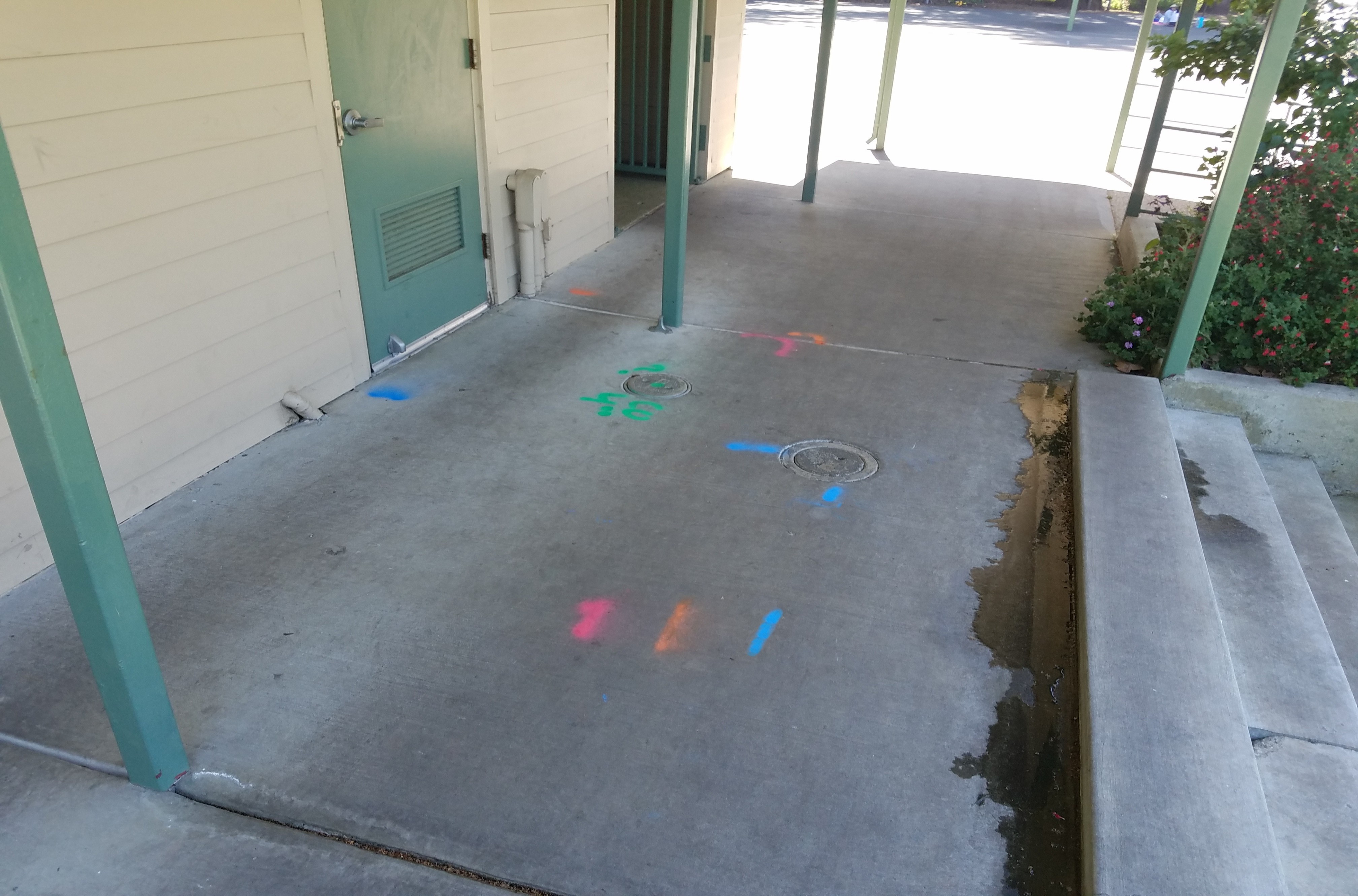
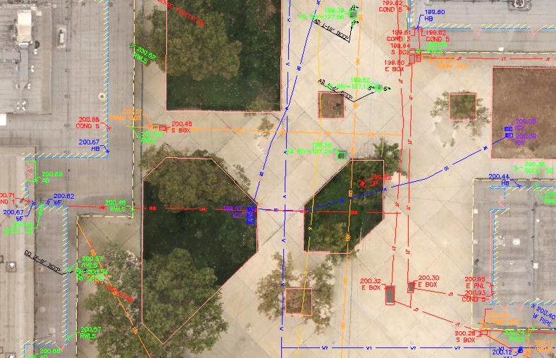
    We routinely perform utility investigations along proposed pipeline routes. After marking the utilities on the ground, air photos are collected to show the relation of the utility markings to the roads, sidewalks, and intersections. The air photos provide valuable visual documentation of the utility markings and road conditions.
Phanton Pro
Phantom 4 Pro Mapping UAV
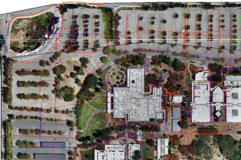
  • Air Photos for Environmental Studies
    During geophysical investigations we use the drone to show the surface conditions at the time of the survey, exactly where data were collected, and the locations of the targets we are looking for, like buried fuel tanks, geologic faults, or other buried features of interest.
Flight Control
Air Photo
  • Utility Investigations for Schools
    Schools are constantly changing. Portables are added and moved. A drawing just a few years old can be out of date. After marking the utilities at a school, the air photo not only shows where the utilities are, it also shows the current configuration of portables, hardscape, and fields.
Flight Control
UAV Flight Control

Recent Projects

Below are four examples of after survey air photos

West Valley College

West Valley College

Natomas Avenue

Natomas Avenue and Riley Street

West Valley College
Field Utility Markings
Close Up
Student Parking Close Up
Natomas Road
Field Utility Markings
Close up
Intersection Zoomed In


Gas Station

Valley Condominiums

South Valley

South Valley Middle School

Magnetic Composit Map
Street markings
Radar Profile
Backyard Close Up
Field Markings
Hallway
CAD Drawing
Quad Area Only

J R Associates Civil and Environmental Geophysics

Morgan Hill · California · 408-293-7390

jra@greatgeophysics.com