Recent Projects
Below are four examples of recent utility investigations
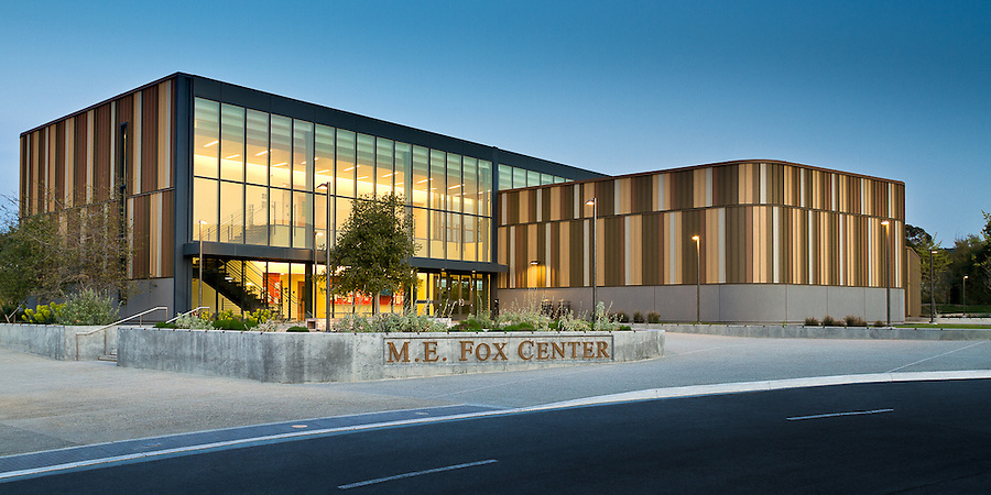
West Valley College
We performed an utility investigation at West Valley College in support of ongoing campus renovations.
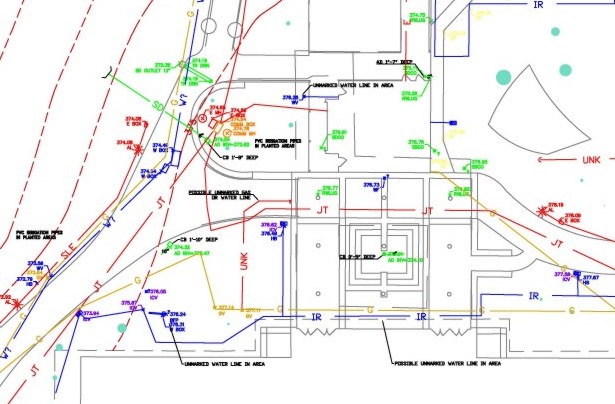
SMUD Electrical Improvements
This recent utility investigation was along a proposed two-mile long buried pipeline route.
.jpg)

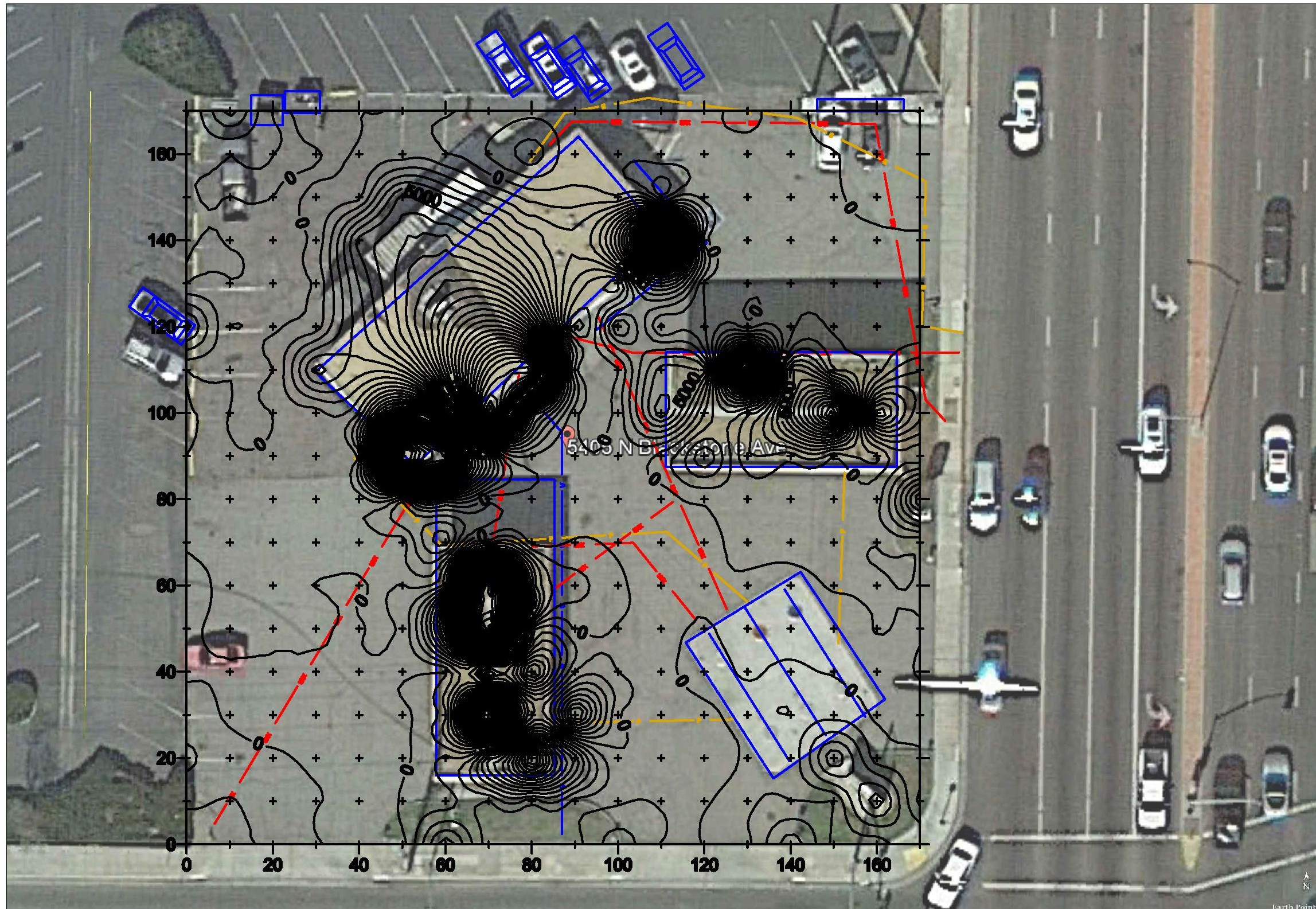
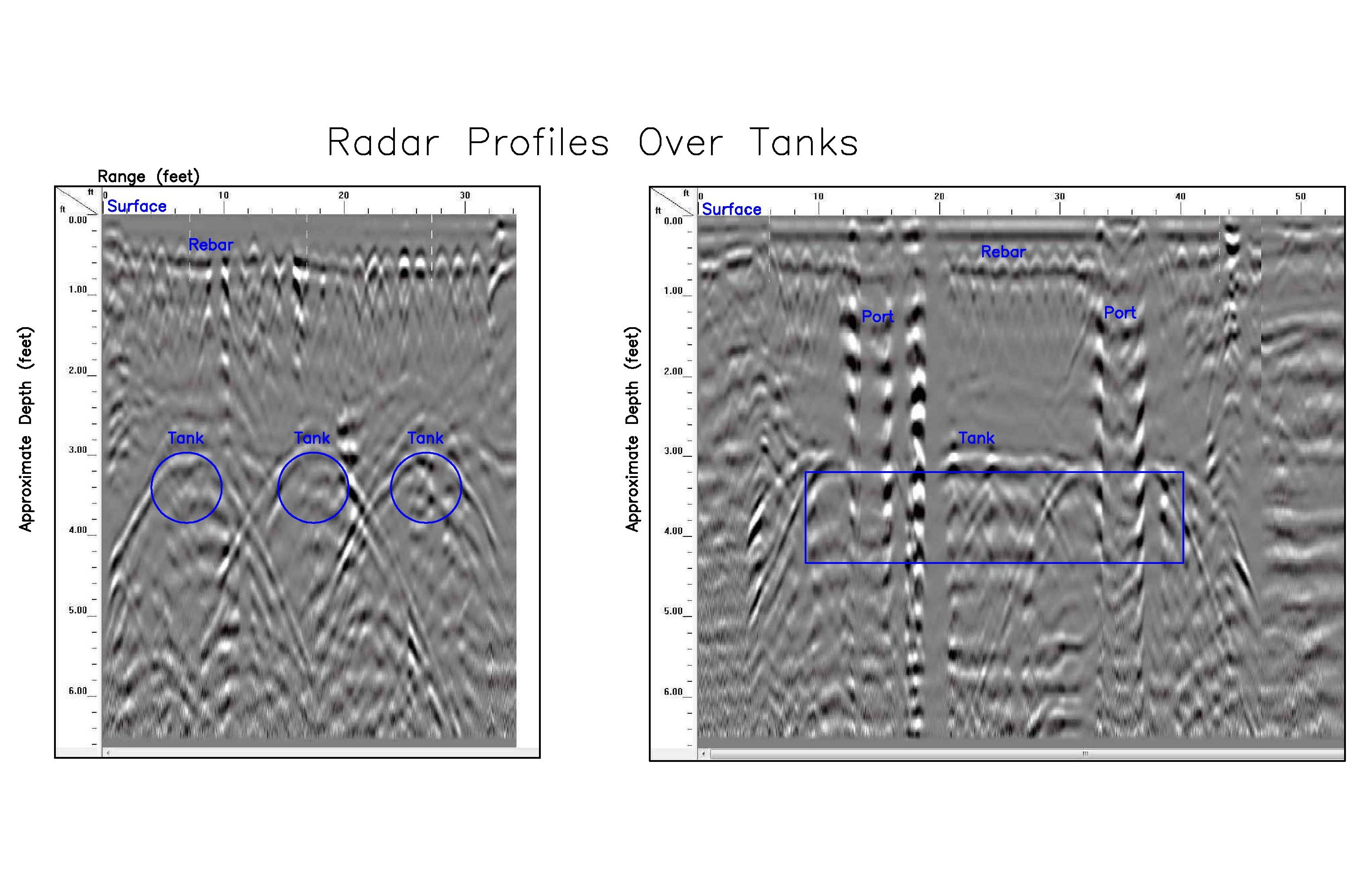
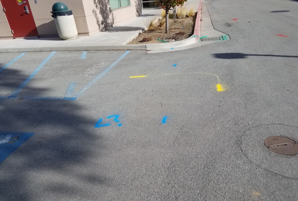
Gas Station, Fresno
This is an example of a typical gas station site where magnetics and ground penetrating radar along with standard pipe and cable locating were used to find utilities and look for unknown abandoned buried tanks.
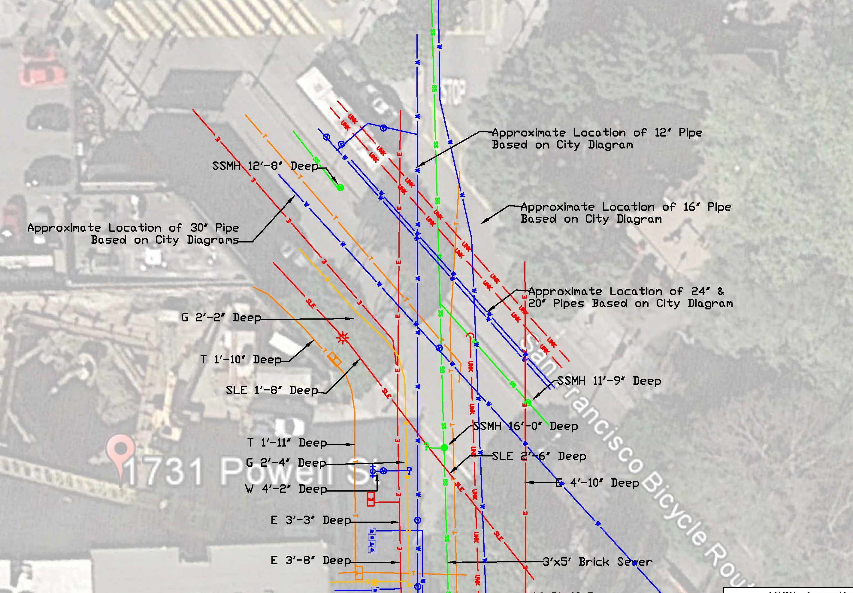
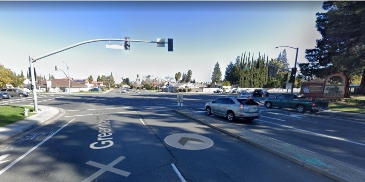
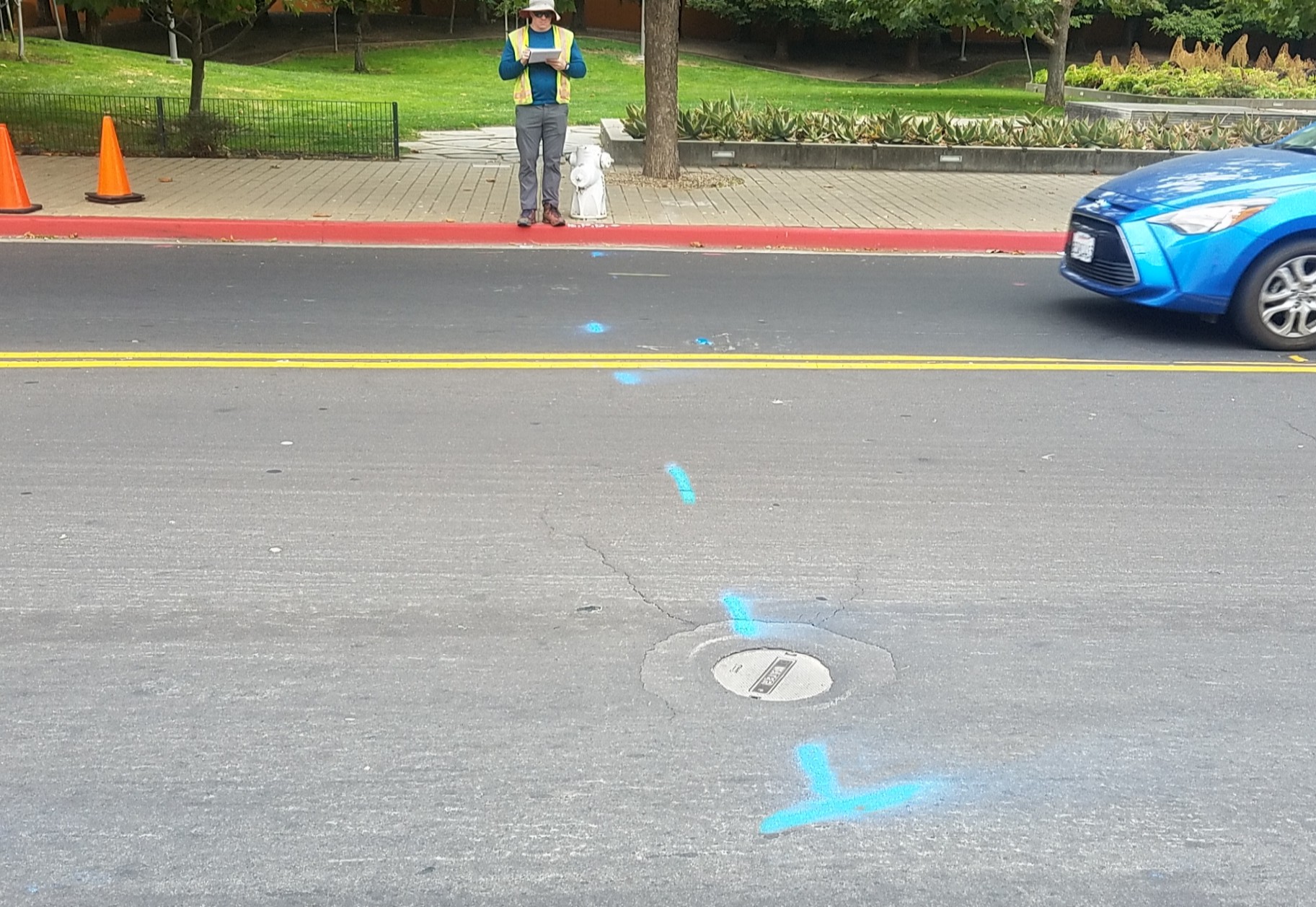
Utility Investigation at an Urban Street Corner
This represents an investigation where both utility locations and depths were needed for a construction project.